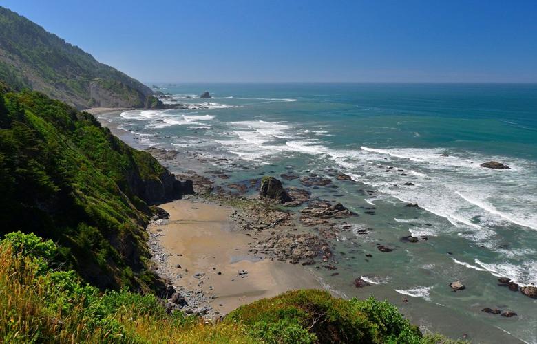
Coastal mountain ranges are forming as material from the ocean is scraped off the top of the subducting Juan de Fuca Plate. This photo shows¬ÝRedwood National and State Parks in California.
Coastal mountain ranges are forming as material from the ocean is scraped off the top of the subducting Juan de Fuca Plate. This photo shows¬ÝRedwood National and State Parks in California.
Scientists have mapped one of the most hazardous spots on the globe in unprecedented detail: a 600-mile geologic boundary just off the Pacific Northwest coast.
Along this fraught stretch, called the Cascadia Subduction Zone, two pieces of the Earth’s crust slide against each other, building up stresses capable of unleashing a catastrophic 9.0-magnitude earthquake and generating a tsunami, with waves as high as 40 feet.
Because scientists don’t know when that day will arrive, they prepare by trying to better understand the geological state of play.
To do that, a 235-foot ship cruised for 41 days along the coast of Oregon, Washington and British Columbia in summer of 2021, sending sound waves deep into the ocean and recording the echoes with a “streamer” — a 9-mile-long waterproof cable containing 1,200 specialized microphones. Similar to how doctors use ultrasound to see inside the body, they used the data to construct a comprehensive map of the underwater geology in a study published Friday in the journal . The new resource will help scientists understand the range of earthquake and tsunami scenarios — and help policymakers devise building codes that protect people.
This photo from the National Oceanic and Atmospheric Administration shows a map and tips for tsunami survival.¬Ý
NOAA
The entire area, which stretches from Northern California to Vancouver Island, is at risk. But the scientists found that the geometry of the fault off the coast of Washington, where the fault is flat and smooth, closer to the surface and extends farther onshore, may be particularly at risk.
“I’m excited to use these results to make sure the shaking estimates I’m producing are as accurate as they can be,” said Erin Wirth, a seismologist with the United States Geological Survey who was not involved in the study. “I’ll be busy now.”
Cascadia Subduction Zone comes into focus
For hundreds of years, the Cascadia Subduction Zone has been quiet. But on Jan. 26, 1700, the earth shook. Japanese history records show an “orphan” tsunami traveled across the Pacific, with no preceding quake. Native American oral histories describe earth shaking and marine flooding. Analysis of tree rings from “ghost forests” that died when the land abruptly subsided helped scientists pin down the date. Scientists estimate that on that day more than three centuries ago, a magnitude-9 quake struck.
A view of the Cascadia Subduction Zone.
Oregon Department of Emergency Management
This fault zone is hazardous is because it’s a “megathrust” fault. One piece of the Earth’s crust, a tectonic plate called the Juan de Fuca plate, dives down beneath the North American continental plate. These plates move at the rate fingernails grow, but also get stuck and build up stresses. The 2011 Tohoku earthquake in Japan and the 2004 Indian Ocean earthquake and tsunami occurred at subduction zones.
But to understand earthquakes, details matter. And seismologists typically learn those details by observing smaller earthquakes that pop off subduction zones. Since Cascadia has been eerily quiet in recent human history, many specifics remain fuzzy.
“We had models for what the fault zone looked like, but they were based on no data for much of the margin, and little bits of data and old quality data,” said Suzanne Carbotte, a marine seismologist at the Columbia Climate School’s Lamont-Doherty Earth Observatory, who led the study. “It’s kind of like you had Coke bottles over your eyes, and they’ve been removed, and you’ve got the proper prescription. Now you can see where the fault zone is. And not surprisingly, the fault surface is way more complex than the picture we had before.”
Danger zone off the Washington coast
The new study is expected to be the first of many scientific papers out of the new data set, but already scientists have made a few key findings. There is a particularly flat and smooth portion of the fault, spanning the state of Washington up to southern Vancouver Island. At other similar fault systems across the world, those areas often cause the largest and most destructive earthquakes. That section of the fault is also shallow and closer to the surface than previous models, which could make it more hazardous, Wirth said.
Scientists also found four segments along the fault, deepening the question about whether the whole fault will go at once, or whether segments could rupture individually.
“That’s the messy question, where the answer is more like: sometimes it does one thing, and sometimes another,” said Harold Tobin, a seismologist at the University of Washington and an author of the paper. Either scenario would constitute a major natural disaster, perhaps the difference between one magnitude-9 and two magnitude-8 earthquakes. Tobin pointed to a pair of massive earthquakes in Japan in 1944 and 1946 in which two different segments of a fault ruptured in short order, both causing deadly tsunamis.
Kelin Wang, a research scientist for Geological Survey of Canada, has already begun using the data to better understand how tsunamis could form.
“It’s such an overwhelmingly rich data set that provides so much information, in many directions,” Wang said.
Keep it Clean. Please avoid obscene, vulgar, lewd,
racist or sexually-oriented language. PLEASE TURN OFF YOUR CAPS LOCK. Don't Threaten. Threats of harming another
person will not be tolerated. Be Truthful. Don't knowingly lie about anyone
or anything. Be Nice. No racism, sexism or any sort of -ism
that is degrading to another person. Be Proactive. Use the 'Report' link on
each comment to let us know of abusive posts. Share with Us. We'd love to hear eyewitness
accounts, the history behind an article.


(0) comments
Welcome to the discussion.
Log In
Keep it Clean. Please avoid obscene, vulgar, lewd, racist or sexually-oriented language.
PLEASE TURN OFF YOUR CAPS LOCK.
Don't Threaten. Threats of harming another person will not be tolerated.
Be Truthful. Don't knowingly lie about anyone or anything.
Be Nice. No racism, sexism or any sort of -ism that is degrading to another person.
Be Proactive. Use the 'Report' link on each comment to let us know of abusive posts.
Share with Us. We'd love to hear eyewitness accounts, the history behind an article.